An upper peninsula map is the single most useful thing you can pack for a trip to Michigan’s Upper Peninsula. The region, known to locals simply as the U.P., covers more than 16,000 square miles of forests, waterfalls, lakeshores, and small towns, and it is easy to underestimate just how big it is. Without a good upper peninsula map, you can spend hours driving between places that looked close together on a small screen. With one, you can group nearby sights into a single day, find the roads that hug the lakeshore, and plan a trip that feels relaxed instead of rushed.
This guide explains how to read an upper peninsula map, breaks the region into its three main areas, and walks through the towns, waterfalls, and scenic drives you should not miss. Whether you are planning your first visit or your tenth, a good map will help you see more and stress less.
Why You Need an Upper Peninsula Map
An upper peninsula map is more than a navigation tool. It helps you picture the region, estimate driving times, and group nearby attractions into one sensible route. The Upper Peninsula sits north of Michigan’s Lower Peninsula and is connected to it by the Mackinac Bridge, one of the longest suspension bridges in the world. It borders Wisconsin to the southwest and is surrounded by three Great Lakes: Lake Superior to the north, Lake Michigan to the south, and Lake Huron to the southeast.
The region holds about 29 percent of Michigan’s land area but only about 3 percent of its people. The 2010 census counted a population of about 311,361 across the whole peninsula. That low population is part of the charm: long stretches of road run through quiet forest, and many of the best views have no crowds at all.
But it also means that gas stations, restaurants, and cell service can be far apart. A paper map, or an offline map downloaded to your phone, is a smart backup in places where your signal drops out, such as parts of Hiawatha National Forest, the Keweenaw Peninsula, and several state parks. Download your offline upper peninsula maps before you leave larger towns like Marquette or St. Ignace.
Upper Peninsula Map Quick Facts
Here are the key facts to keep in mind when you look at any upper peninsula map:
- Size: about 16,377 square miles, or 42,420 square kilometres
- Counties: 15
- Waterfalls: more than 300
- Population: about 311,361 people (2010 census)
- Largest city: Marquette, with about 21,355 people
- Lakes: Lake Superior, Lake Michigan, and Lake Huron
- Bridge to the Lower Peninsula: the Mackinac Bridge
- Border: Wisconsin to the southwest
How to Read an Upper Peninsula Map
Most upper peninsula maps split the Upper Peninsula into three areas: the eastern, central, and western U.P. This split follows the shape of the land and the way people actually travel. The eastern U.P. is the gateway after you cross the Mackinac Bridge. The central U.P. holds the region’s most famous sights, including Pictured Rocks and Tahquamenon Falls. The western U.P. is the wildest part, with the Porcupine Mountains and the Keweenaw Peninsula.
The main highways to learn are US-2, which runs east to west along the southern edge, and M-28, which runs east to west through the middle. US-41 runs north through the center to the Keweenaw Peninsula. Once you know these three roads, the rest of the upper peninsula map starts to make sense, and you can plan loops instead of driving back the way you came.
The Eastern Upper Peninsula on the Map
The eastern Upper Peninsula is the first stop after crossing the Mackinac Bridge, and it rewards travelers who slow down instead of rushing west. St. Ignace is one of the oldest cities in Michigan and the main gateway to Mackinac Island. Visitors enjoy waterfront parks, local restaurants, museums, and ferry services to the island, where cars are not allowed and bicycles and horse-drawn carriages rule the streets.
Just north of St. Ignace, Tahquamenon Falls State Park holds one of the largest waterfalls east of the Mississippi River. The Upper Falls spans more than 200 feet across, and its water runs amber-brown, colored by natural tannins from the cedar forests upstream. It is one of Michigan’s most famous natural sights, and it is at its best in autumn, when the forest turns gold and red.
Whitefish Point sits on the Lake Superior shore and is famous for its lighthouse and the Great Lakes Shipwreck Museum, which tells the story of the lake’s many lost ships. Nearby, the small town of Paradise offers lodging, restaurants, beaches, and easy access to the falls and the point. Sault Ste. Marie, on the eastern edge, is famous for the Soo Locks, a series of locks that let huge ships travel between Lake Superior and the lower Great Lakes. Watching a freighter rise or fall through the locks is a slow, fascinating sight that never gets old.
The Central Upper Peninsula on the Map
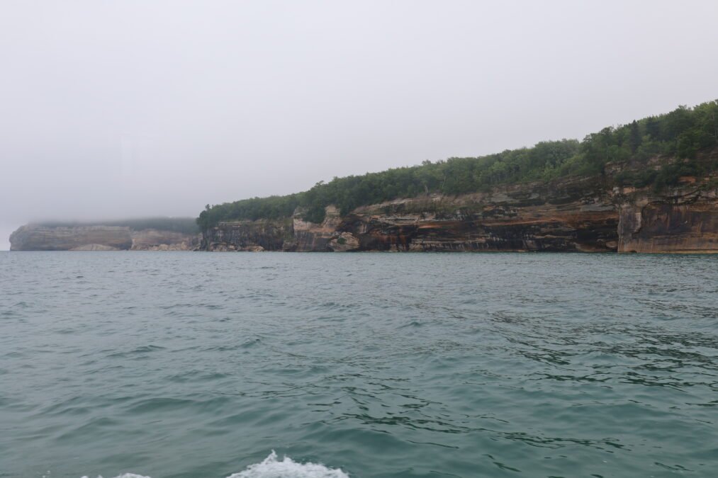
The central Upper Peninsula holds many of Michigan’s most recognizable natural attractions, and it is where most first-time visitors spend the most time. Pictured Rocks National Lakeshore stretches for more than 40 miles along Lake Superior, with colorful sandstone cliffs, waterfalls, sea caves, and quiet beaches. You can see the cliffs from a boat tour, a kayak, or the hiking trails above, and each view feels different.
Munising is the main gateway town to Pictured Rocks. It offers restaurants, hotels, a marina, and easy access to several famous waterfalls, including Munising Falls, Miners Falls, Wagner Falls, and Alger Falls. Many visitors base themselves in Munising for two or three days and explore the lakeshore from there.
Marquette is the largest city in the Upper Peninsula, with about 21,355 people, and it makes a wonderful base for families. It has waterfalls, museums, a lively downtown, sandy beaches, and some of the most beautiful sunsets on Lake Superior. Sugar Loaf Mountain, just outside town, gives a short hike with a big payoff: a wide view over the lake and the city.
Kitch-iti-Kipi, near Manistique, is a natural spring with water so clear you can watch fish swim far below your feet. A small raft, pulled by hand along a cable, takes you across the spring for a close look. Seney National Wildlife Refuge, also in the central U.P., is a quiet place to watch birds, beavers, and wildflowers along a driving loop and walking trails. Grand Island, off the Munising shore, offers sea caves, beaches, and bike trails for a day trip by ferry.
The Western Upper Peninsula on the Map
The western Upper Peninsula is the wildest and least crowded part of the region, and it is the favorite of many returning visitors. Porcupine Mountains Wilderness State Park is the largest state park in Michigan, with dense forests, rivers, waterfalls, and the famous Lake of the Clouds, a small lake ringed by forested hills that glows at sunset. The park’s trails range from easy boardwalks to long backcountry hikes, so there is something for every level of fitness.
Copper Harbor sits at the very tip of the Keweenaw Peninsula, the finger of land that points north into Lake Superior. It is known as the gateway to Isle Royale National Park, and daily passenger ferries carry visitors to the island. Brockway Mountain Drive, between Copper Harbor and Eagle Harbor, is one of the most scenic roads in the Midwest, with wide views over the lake and the forest.
Bond Falls, near Paulding, is one of the most photographed waterfalls in the region, with water spilling over wide rock ledges into a calm pool below. The historic mining towns of the Keweenaw tell the story of Michigan’s copper boom: Calumet, Hancock, and Houghton all have handsome old buildings, museums, and mine tours. Houghton is home to Michigan Technological University, and its waterfront and college-town energy make it a fun stop. Iron Mountain, farther south, is known for outdoor activities and for Pine Mountain, one of the most impressive ski-jumping hills in the world.
Upper Peninsula Map: Main Towns and Cities
The table below lists the largest cities on the upper peninsula map, with their approximate populations from the 2010 census. These are the towns with the most lodging, restaurants, and services, so they make the best bases for a trip.
| Town or City | Approximate Population | Best Known For |
|---|---|---|
| Marquette | 21,355 | Largest city, beaches, sunsets, downtown |
| Sault Ste. Marie | 14,144 | Soo Locks, ships, history |
| Escanaba | 12,616 | Lake Michigan shore, fishing, harbor |
| Menominee | 8,599 | Southern gateway, waterfront, history |
| Houghton | 7,708 | Michigan Tech, Keweenaw, mining history |
| Iron Mountain | 7,624 | Ski jumping, outdoor sports, mining |
| Ishpeming | 6,470 | Iron mining history, skiing |
| St. Ignace | 2,300 | Mackinac Island ferries, gateway town |
| Munising | 2,300 | Pictured Rocks gateway, waterfalls |
| Copper Harbor | 100 | Isle Royale ferries, scenic drives |
Best Places to Stay in the Upper Peninsula
Choosing where to stay depends on what kind of trip you want. Here are four good bases, each with its own character:
- Houghton: best for first-time visitors. This university city on the Keweenaw Peninsula offers non-stop fun in every season, with museums, mine tours, lake views, and easy access to Copper Harbor and the Porcupine Mountains.
- Marquette: best for families. It has the most hotels, restaurants, and activities in the U.P., plus beaches, waterfalls, museums, and sunsets that everyone can enjoy.
- Iron Mountain: best for outdoor activities. It sits near ski hills, snowmobile trails, fishing lakes, and the Pine Mountain ski jump, and it works well in both summer and winter.
- St. Ignace: best for peace and quiet. This small town on the Straits of Mackinac is a calm base with ferries to Mackinac Island, waterfront parks, and easy access to the eastern U.P.
Book early if you travel in summer or during autumn color season, because the best lodges and cabins fill up fast. In winter, check road conditions and make sure your lodging is open year-round, since some small inns close in the cold months.
Scenic Drives to Trace on Your Upper Peninsula Map
Some of the best moments in the U.P. happen on the road itself. Here are the drives worth tracing on your upper peninsula map before you go:
- Brockway Mountain Drive: a short, winding road between Copper Harbor and Eagle Harbor with sweeping views over Lake Superior. Go at sunset if you can.
- US-2 along Lake Michigan: the southern route across the peninsula, with sandy beaches, small towns, and long views over the water.
- M-28 through the center: the main east-west road, passing forests, lakes, and the towns of Munising, Marquette, and Wakefield.
- The road to Whitefish Point: a quiet drive north from Paradise to the lighthouse and the Shipwreck Museum on the Superior shore.
- The Keweenaw Peninsula loop: a full-day drive from Houghton to Copper Harbor and back, past mines, lighthouses, and lake views.
Take your time on these roads. The speed limits are low in places, wildlife crosses at dawn and dusk, and the best views often appear around a bend with no warning. Pull off safely when you want a photo.
Planning a Trip With Your Upper Peninsula Map
A little planning with your upper peninsula map goes a long way in the U.P. Here is a simple approach that works for most trips:
- Pick one region per trip. The peninsula is too big to see in a weekend. Choose the east, the center, or the west, and save the rest for next time.
- Book lodging first. The best places fill up early, especially near Pictured Rocks and in the Keweenaw.
- Group sights by area. Use your upper peninsula map to cluster waterfalls, towns, and trails that sit close together, so you spend less time driving and more time exploring.
- Download offline upper peninsula maps. Cell service fades in the forests and parks. Save your maps in advance and carry a paper map as a backup.
- Pack for changing weather. Lake Superior can turn a warm day cold in an hour. Bring layers, rain gear, and sturdy shoes, even in summer.
- Leave room for surprises. Some of the best U.P. moments are unplanned: a roadside waterfall, a quiet beach, a small-town diner with the best pasty you have ever tasted.
A pasty, by the way, is the U.P.’s signature food: a hand-held pie filled with meat, potato, and rutabaga, brought by Cornish miners long ago. Trying one is almost a rite of passage, and every town seems to have its own favorite bakery.
Final Thoughts on the Upper Peninsula Map
An upper peninsula map is more than a piece of paper or a phone screen. It is the key to a region that rewards slow travel, careful planning, and a willingness to wander. From the amber water of Tahquamenon Falls to the painted cliffs of Pictured Rocks, from the Soo Locks to the Lake of the Clouds, the Upper Peninsula holds some of the most beautiful landscapes in the American Midwest. Its towns are small, its forests are deep, and its lakes are vast, and a good map helps you find your way through all of it.
So before your next trip north, study your upper peninsula map, pick a region, book a room, and download your offline maps. Then cross the Mackinac Bridge, roll down the window, and let the wild north do the rest. The Upper Peninsula has been waiting for you, and with a map in hand, you are ready to explore it properly.